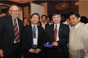
PHILIPPINES HOST THE 2011 ESRI ASIA PACIFIC USER CONFERENCE


The Philippines was chosen as the site for this year's Esri Asia Pacific User Conference (APUC) based on the rapid growth of the adoption of GIS technology in the country and in the Asia Pacific Region. The APUC was held last January 26 & 27, 2011 at the EDSA Shangrila Hotel in Mandaluyong City.
The two-day conference was well attended by more than 700 practitioners, managers, project managers, consultants, educators of geographic information system (GIS), IT professionals, decision makers, and users of GIS from various sectors around the Philippines and in the Asia Pacific region.
Also in attendance were the various distributors of Esri in the Asia Pacific region, namely, Esri South Asia, Esri Japan, Esri Korea, Esri Thailand, Esri China (Beijing) Ltd., Eagle Technology Group Ltd. Of New Zealand, Esri Australia, and NIIT Technologies Pte. Ltd. of India.
With the theme 'One Community, One Map', the conference focused on the need for national and community mapping programs to provide a common map framework by which governments and organizations in the Asia Pacific region can build and share consistent, authoritative, current physical social, political, cultural, economic and environmental information for any geographical area of interest or community.
Participants and delegates were treated to various technical presentations and discussions on the applications of GIS in various industries and fields such as: utilities and communications, agriculture, public safety, emergency response, disaster management, defense and intelligence, environment, natural resources, energy, transportation and logistics.
An added attraction was the Exhibit Hall that displayed information and technologies from companies like NAVTEQ, NIIT Technologies, New Zealand Aerial Mapping Ltd, MWH Soft, Trimble, ARCHIBUS Inc, and the National Mapping and Resource Information Authority (NAMRIA) of the Philippines. A map gallery and a demo theatre were also featured.
The keynote speaker for the event was no less than the Founder and Esri President Jack Dangermond, a pioneer in spatial analysis methods. Mr. Dangermond spoke about the growing role and the new modality that GIS is assuming in science, in government, in public safety and security, in commerce and finance, in telecommunications, and in National Defense. He encouraged the participants to create a community of GIS professionals and to come up with "one map” that will dynamically bring all the geographic information together. Mr. Dangermond was also joined by two keynote speakers from the government sector; Secretary Ivan John E. Uy of the Philippines' Commission on Communications and Information Technology (CICT), who discussed “E-governance Programs and the Importance of GIS in National Initiatives" and by Administrator Peter N. Tiangco, Ph.D, of NAMRIA, who presented his topic "Towards the Establishment of the Philippine Spatial Data Infrastructure (PSDI)".
This well-organized and successful was arranged by Geodata Systems Technologies, Inc., a sister company of Geodata Solutions Inc.